Flight planning can begin the day before a flight by gaining awareness of forecast weather through an outlook briefing or simply watching the evening weather report. To plan an IFR flight, you should have available the appropriate IFR enroute and area charts, approach charts, the Notices to Airmen Publication, the A/FD, the POH or AFM for the airplane to be flown, and access to the AIM.
The pilot in command is required to become familiar with all available information concerning that flight. This information must include weather reports and forecasts, fuel requirements, alternatives available if the flight cannot be completed as planned, any known traffic delays, runway lengths, and expected takeoff and landing distances.
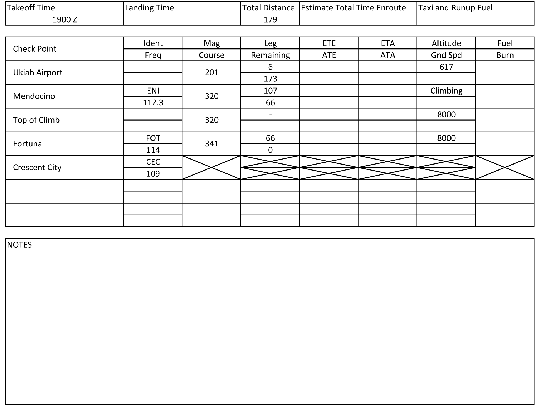
Let's say we're planning a flight from Ukiah, California to Crescent City. To begin the flight planning by determining a route and listing route fixes, distances, frequencies, and altitudes to be used on the flight log. We decide to fly from Ukiah Airport directly to Mendocino VORTAC to join victor 27 northbound. FAR 91.177 states the altitude we use must be at least 1,000 feet above any terrain or obstructions within 4 nm of the centerline of the route of flight, or 2,000 feet above in designated mountainous areas. Our chosen altitude of 8,000 feet meets this requirement. An even altitude was chose since the magnetic courses used are between 180 and 359 degrees. For eastbound magnetic courses, even altitudes should be used.
Remember oxygen requirements when selecting a cruising altitude. Crew must use oxygen after 30 minutes at cabin pressure altitudes above 12,500 feet MSL at at all times at cabin pressure altitudes above 14,000 MSL. Every occupant of the aircraft must be provided oxygen at cabin pressure altitudes above 15,000 feet MSL.