There are no NOTAMs which should affect our flight. The area forecast informs us that ceilings along the route of flight should be running around 1,000 feet with visibilities of about 3 miles. Tops are at 1,500 feet. The relevant line of the area for our route reads:
NRN 1/3 CSTLN...OVC010 TOP 015. VIS 3SM BR. 20Z BKN010. VIS 3-5SM BR. OTLK...IFR CIG BR.
The severe weather outlook states no severe weather is expected, and there are no severe weather warnings, SIGMETs, or convective SIGMETs issued for the region. There is an AIRMET for IFR conditions, which we already know about, and for turbulence. However, our route does not take us through the area described in the AIRMET TANGO. No icing is expected. Finally, a check of FDC NOTAMs reveals nothing for the airports we intend to use. This is important to check, since FDC NOTAMs often involve changes to instrument approach procedures.
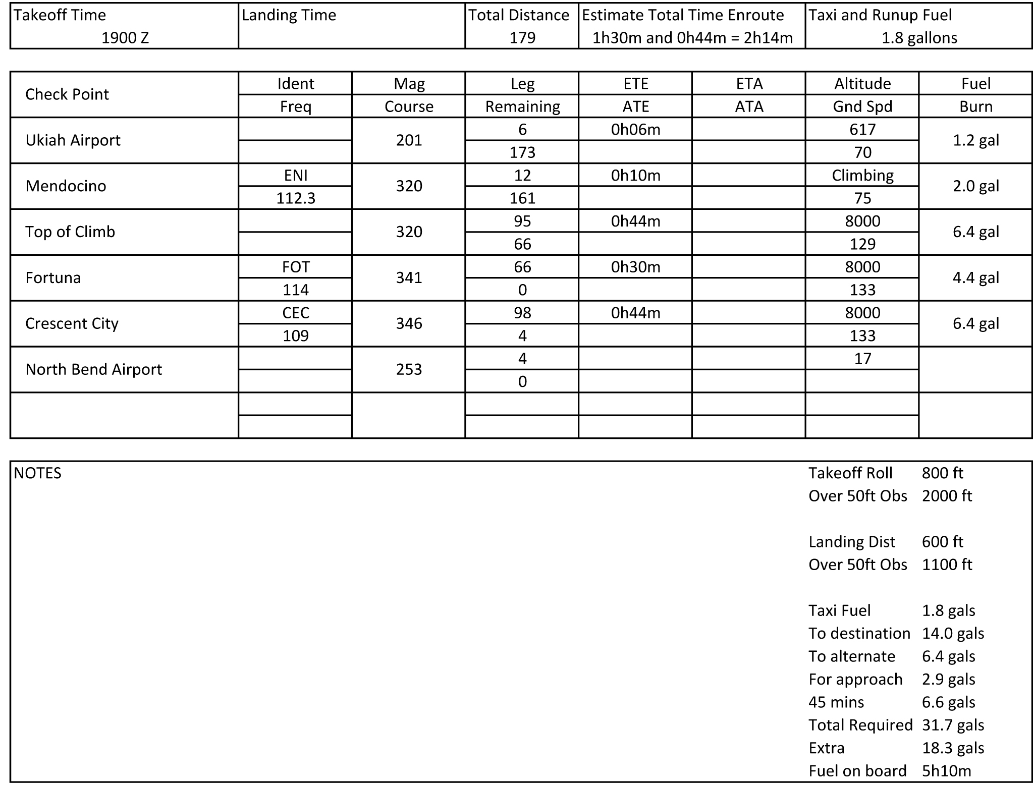
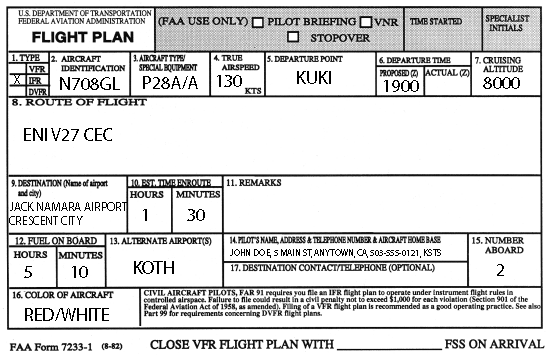
It is now time to perform the rest of the calculations, such as computation of times, fuel burn, takeoff and landing distances, cruise power setting, true airspeed, and weight and balance. Fuel required for IFR flights is the amount of fuel it takes to get to the destination airport, from there to the alternate airport, and then fly for 45 minutes at cruise power. After these computations are finished, the completed flight log might look something like this:
At this point, we would call the flight service station for an updated weather briefing and file the flight plan. Obtain updated reported weather and pilot reports. If available, check the surface analysis and weather depiction charts. This would also be a good time to check the radar summary chart if the possibility of thunderstorms exists in the region.
The winds aloft forecast gives wind direction in reference to true north. The presentation of some questions on your knowledge test may require you to convert the winds aloft to magnetic winds aloft to obtain the correct answer, in order to ensure you know this fact.