Once you transitioned to the enroute portion of your flight, you will fly be reference to enroute charts. These charts, and all other US Government charts, are produced and maintained by AeroNav Products.
Enroute charts are either high or low altitude. High altitude enroute charts are used when at or above FL 180. They depict J and Q routes, radio aids, selected airports, special use airspace, and other information related to flight at these altitudes. Low altitude charts are basically the equivalent in use to a sectional chart for instrument flying.
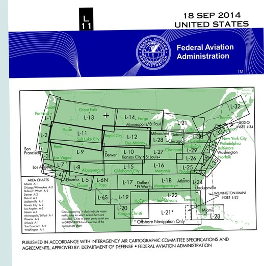
An index map on the chart cover shows coverage areas. The charts effective date is printed on the other side of the folded chart. Information concerning military training routes, the off route obstruction clearance altitude (OROCA), and the chart legend is also shown.
En route charts are revised every 56 days.
Area charts are published for areas with congested or complex airspace. These charts provide a closer, more detailed depiction of these areas. They contain the same information as can be found on the low enroute charts.
In order to use enroute charts, we must be familiar with how AeroNav depicts information.
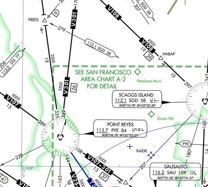
Distances between navaids are charted as a number inside a box. The changeover point between two navaids is shown as a dividing line with numbers indicating the distance at which to change the VOR frequency. A frequency change might be required at a specific changeover point to maintain signal coverage or avoid a conflicting frequency. Where no changeover point is depicted, you should change navaid frequencies at the midway point.
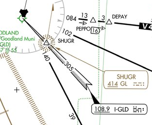
Intersection can be identified with an off course navaid or DME. A hollow arrowhead pointing to the intersection indicates the use of DME is authorized to identify the intersection. A D shaped symbol with a number inside indicates the DME milage inside the D is the cumulative distance of route segments.
If a feathered arrowhead is used, it indicates a localizer is used to identify an intersection. If the feathered markings are drawn on the right side of the course, the depicted navaid is a localizer. If the feathered markings are on the left side, the navaid used is a localizer back course. In determining left and right, the arrowhead should be viewed as if you are flying down the approach course, from the wide end toward the pointed end.
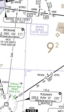
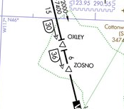
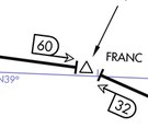
An open triangle depicts the location of an air traffic control reporting point. If the triangle is solid, the reporting point is compulsory. Other location symbols, such as wapoints and navaids may be open or solid, as well, with the same meaning. You must report compulsory reporting points when not in radar contact, and any reporting point upon request of air traffic control.
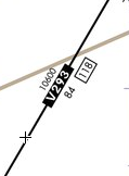
Where an "x" appears along a route without an intersection, the x is a mileage breakdown or computer navigation fix.

Approved IFR GPS units may be used to report intersections.
Holding patterns are depicted, which allow air traffic control to instruct pilots simply to "hold as published" at the hold point.

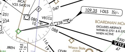
ARTCC boundaries and frequencies are notes as blue serrated lines on the chart.


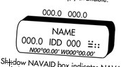
If a navaid information box is shadowed, it indicates a flight service station of the same name is associated with the facility. If a flight service station is located separate from any navaid, a smaller shadowed box is depicted, which contains the name and identifier of the flight service station. Flight service frequencies are provided above the box.

Low altitude enroute chart legends are available during the knowledge test. Refer to legend 23, 24, and 25.