Calculating Estimated Time Enroute
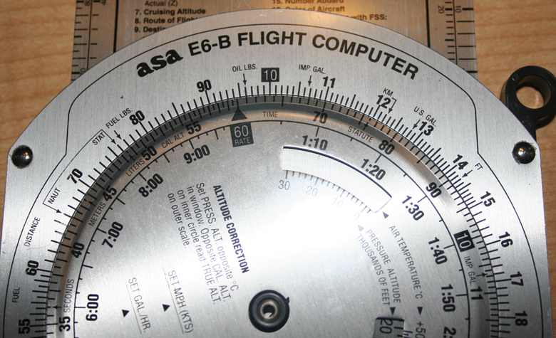
Next, fill in the ETE for each checkpoint. ETE is a simple time, speed, and distance problem. To calculate ETE using a flight computer, first place the groundspeed opposite the rate index mark. Next, find the distance on the outer scale. Time will be indicated on the inner scale.
Most pilots will also add a few minutes to the end of the flight to allow for the pattern to be flown at the destination airport.
Calculating Fuel Burn
Determine the cruise fuel burn from the performance section of the airplane handbook. For this leg, we will say we determined the cruise fuel burn to be 6.0 gallons per hour.
The estimated fuel burn for the flight can be calculated using the flight computer. Place the rate of fuel burn opposite the rate index. Find the time on the inside scale. The fuel burn will be indicated on the outside scale.
Add the estimated fuel burn to the flight log. Do not forget to add the taxi, run-up, and takeoff fuel burn for your airplane, which is usually listed in the performance section of the airplane handbook.
Add Radio Navaid References
Find nearby navaids, if available, for reference during your flight. In this example we've added references to the nearby Talladega and Lagrange navaids. The first visual checkpoint is on the Talladega 117 radial. So, during the flight, we would use the calculated dead reckoning heading to get heading in the right direction. We would be looking to cross the creek about three minutes after we level off at 3,500 feet, or about eight minutes after takeoff.
Prior to getting to the creek checkpoint, we'll tune in the TDG VOR-DME and set radial 117 into the VOR display. As we pass over the creek, we should see the VOR's course deviation needle centered.
In this way, radio navigation and pilotage are used together with dead reckoning to get us where we want to go. Below is an example navigation log with the information for our example flight entered.
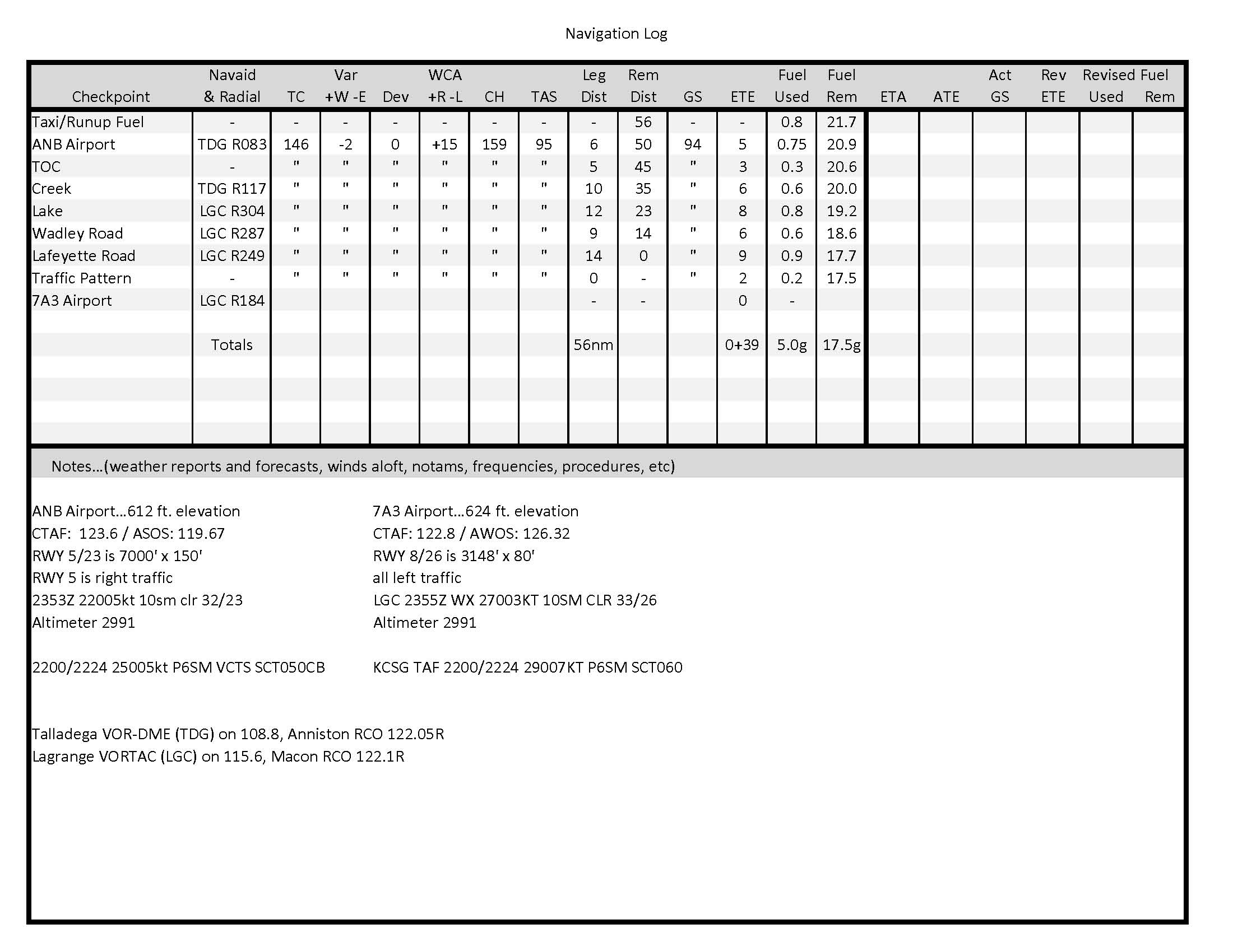
...true course is 146 degrees, minus 2 degrees east variation, plus 0 degrees deviation, plus a 15 degree right wind correction angle, gives us a compass heading of 159 degrees to fly. This means, all things considered, 159 degrees on the compass should keep us close to on the correct path over the ground.